ThinkSpatial: Chris S. Renschler
Building Interdisciplinary Teams for Environmental Management and Conservation Across Scales
Chris S. Renschler, Ph.D.
Dept. of Geography, University at Buffalo (SUNY), Buffalo, NY, USA
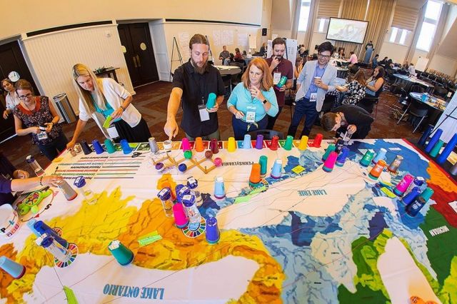
Time-lapse video of participatory mapping exercise pictured above
Abstract: Over the past two years, the National Science Foundation funded the initiation of a regional research network on sustainable development and community resilience in the Lower Great Lakes. OUTSTEPS.org utilizes a novel approach to engage scientists, stakeholders, and Indigenous Rightsholders to look at natural and social processes from a new perspective when addressing regional climate change and land use changes in coastal watersheds. The approach creates interdisciplinary teams to investigate spatial and temporal patterns around conservation and development challenges under climate change. Team individuals identify their expertise and interest in the 17 UN Sustainable Development Goals (SDGs) and the seven PEOPLES Resilience Framework Dimensions. This approach allows participants to converge as matching research partners creating interconnected teams working collaboratively on innovative research questions hypotheses at the regional scale. Several projects at the local scale feature a focus on assessing more detailed process patterns in environmental management and conservation. Among them are process-based modeling of runoff and soil redistribution, bioacoustics and bat habitat assessment, and a discussion to integrate social-cultural aspects in climate change impact and adaption assessment at the local scales.
Bio: Chris S. Renschler is a Professor in Geography and Director of the Geographic Information and Analysis Lab (GIAL) at the University at Buffalo (SUNY), Buffalo, NY. He is also the Director of the Landscape-based Environmental System Analysis & Modeling (LESAM) Lab. Renschler is recognized internationally as an expert and scholar in soil and water conservation, integrated watershed, natural resources, and hazards management. His research, teaching, and outreach activities include the development, validation, and application of integrated hydrology and sediment modeling tools developed collaboratively by scientists, engineers, and practitioners to support effective decision- and policy-making under global climate and land use/land cover change.
The objective of the ThinkSpatial Forum is to exchange ideas about spatial perspectives in research and teaching, broaden communication and cooperation across disciplines among faculty and graduate students, and encourage the sharing of tools and concepts.